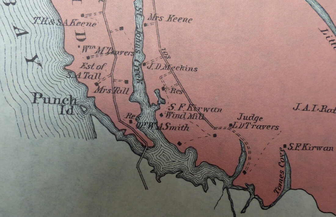
There was also once was a bridge at the south end of the island over Punch Island Creek to Meekins Neck. Unfortunately there are no known photos of the bridge. Pat Neild, born in 1930, recalls seeing the remnants of the old wooden bridge:
"When I was a boy, the remains of the bridge were still visible, as well as the land on the Meekins Neck side. I can only guess that it ended its existence in the very early 1900s. It crossed from Taylors Island to Meekins Neck at the end of the Punch Island road. The Bay has eroded all of that away. The saying was that you could travel from the northern tip of James Island to the southern tip of Hoopers Island, across Taylors Island by road."
"When I was a boy, the remains of the bridge were still visible, as well as the land on the Meekins Neck side. I can only guess that it ended its existence in the very early 1900s. It crossed from Taylors Island to Meekins Neck at the end of the Punch Island road. The Bay has eroded all of that away. The saying was that you could travel from the northern tip of James Island to the southern tip of Hoopers Island, across Taylors Island by road."
Above image is from a late 19th century map which shows the southern part of Taylors Island with the bridge crossing Punch Island Creek.
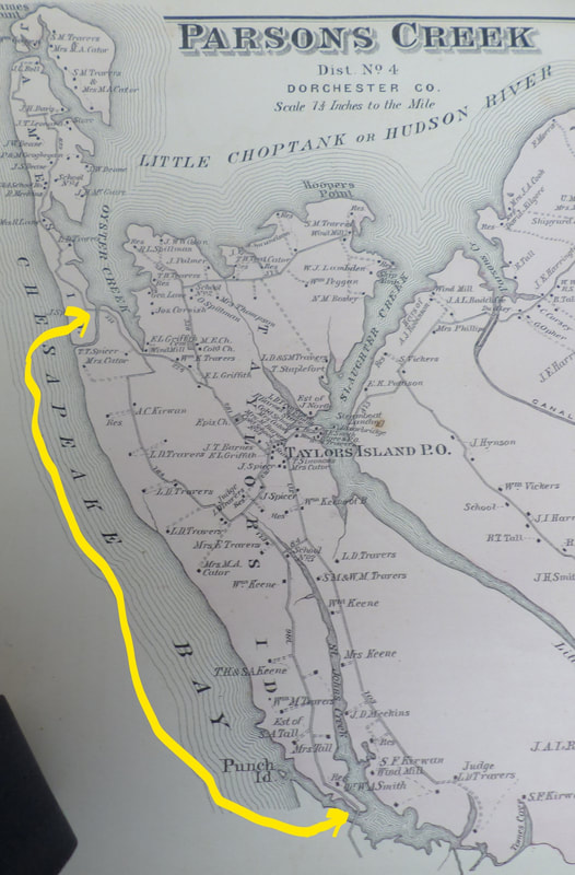
Here is the same map showing all of Taylors Island. Note that road extends all the way from James Island down across Punch Island Creek to Meekins Neck. Interestingly, this same road extended all the way to the south end of Hoopers Island. Thus, in 1877 you could travel from James Island down to the end of Hoopers Island by land on a road parallel to the Chesapeake Bay.


