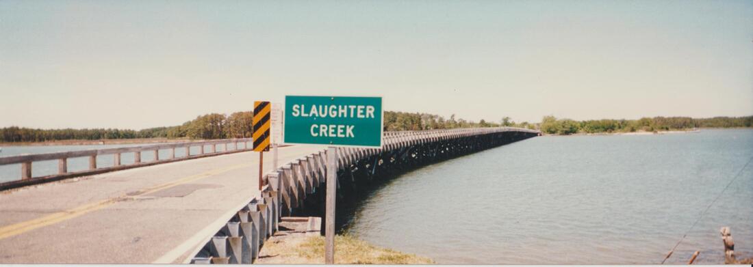
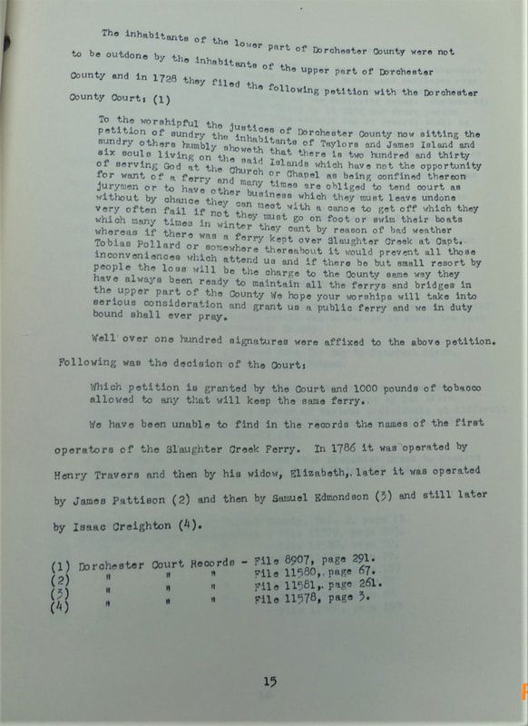
It is said that the creek got its name from a man named Slaughter who was a close associate of the hated 17th century pirate Rodger Makeele. Slaughter chose the creek as his own hideaway. The name Slaughter Creek appears on maps as early as the year 1670.
In 1728 the people of Taylors Island petitioned the justices of Dorchester County for a ferry between the island and the mainland. They cited a population of 236 souls living on the island and their need to attend church as well as do business on the mainland. The justices granted one thousand pounds of tobacco to anyone who would establish the ferry. No records can be found of the ferry's first or earliest operators, but in 1786 Henry Travers held the position and later, his widow.*
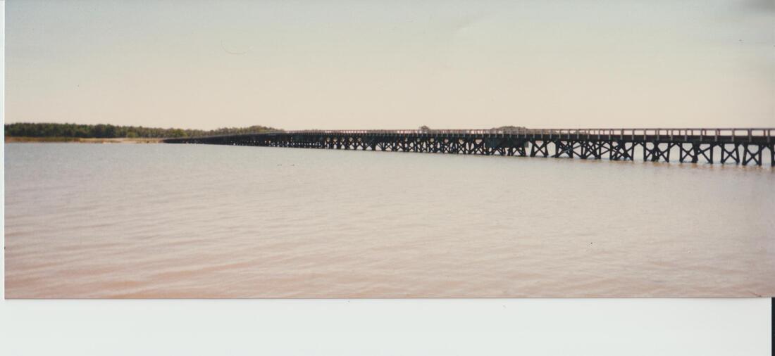
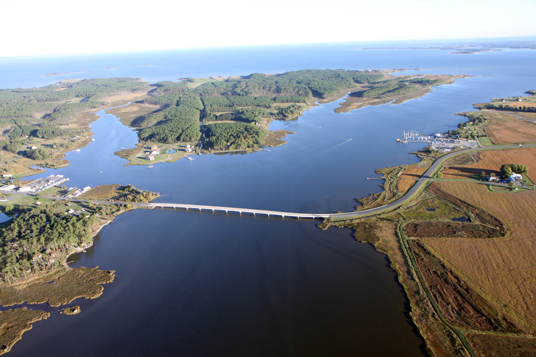
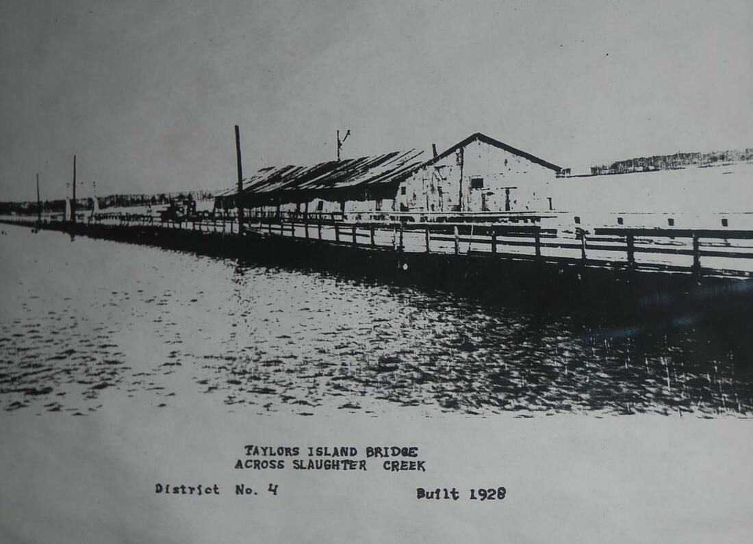
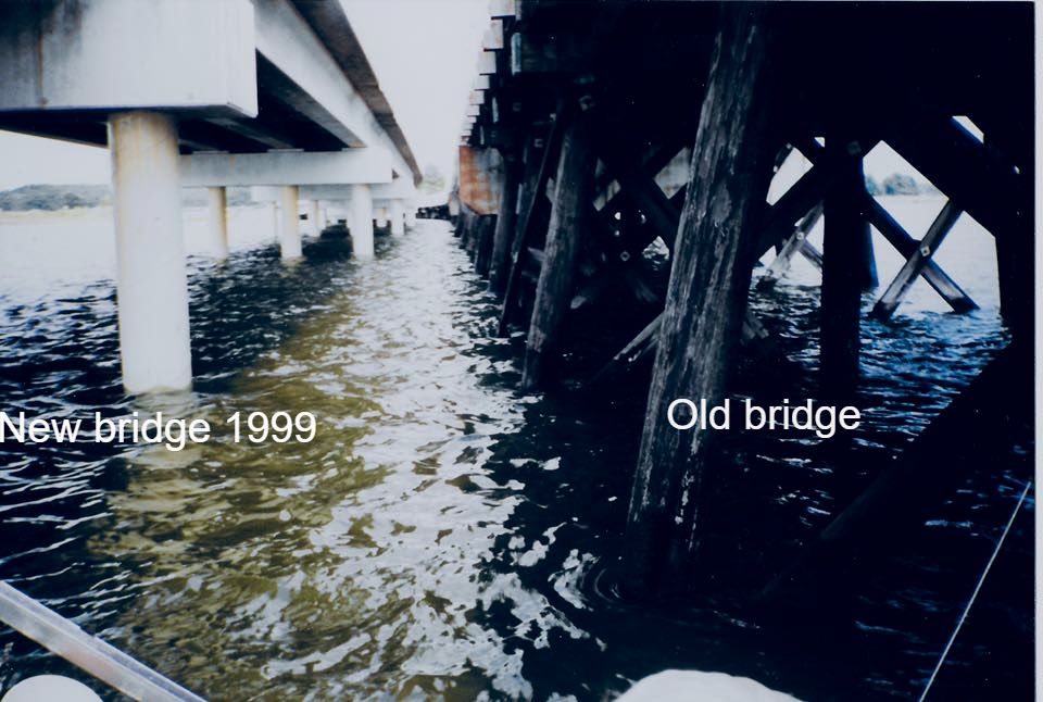
The first bridge was built in 1854. The present bridge is the fourth at the site. The above image is an ariel view of the Slaughter Creek Bridge looking north. This "new bridge" was built in 1999 and replaced a wooden span that was built in 1928 (scroll to the bottom of page to see photos of the dedication ceremony for the new bridge in 1999).
* source - "The Disappearing Islands of the Chesapeake" by William B. Cronin - Johns Hopkins University Press 2005.
In 1728 the people of Taylors Island petitioned the justices of Dorchester County for a ferry between the island and the mainland. They cited a population of 236 souls living on the island and their need to attend church as well as do business on the mainland. The justices granted one thousand pounds of tobacco to anyone who would establish the ferry. No records can be found of the ferry's first or earliest operators, but in 1786 Henry Travers held the position and later, his widow.*
The first bridge was built in 1854. The present bridge is the fourth at the site. The above image is an ariel view of the Slaughter Creek Bridge looking north. This "new bridge" was built in 1999 and replaced a wooden span that was built in 1928 (scroll to the bottom of page to see photos of the dedication ceremony for the new bridge in 1999).
* source - "The Disappearing Islands of the Chesapeake" by William B. Cronin - Johns Hopkins University Press 2005.
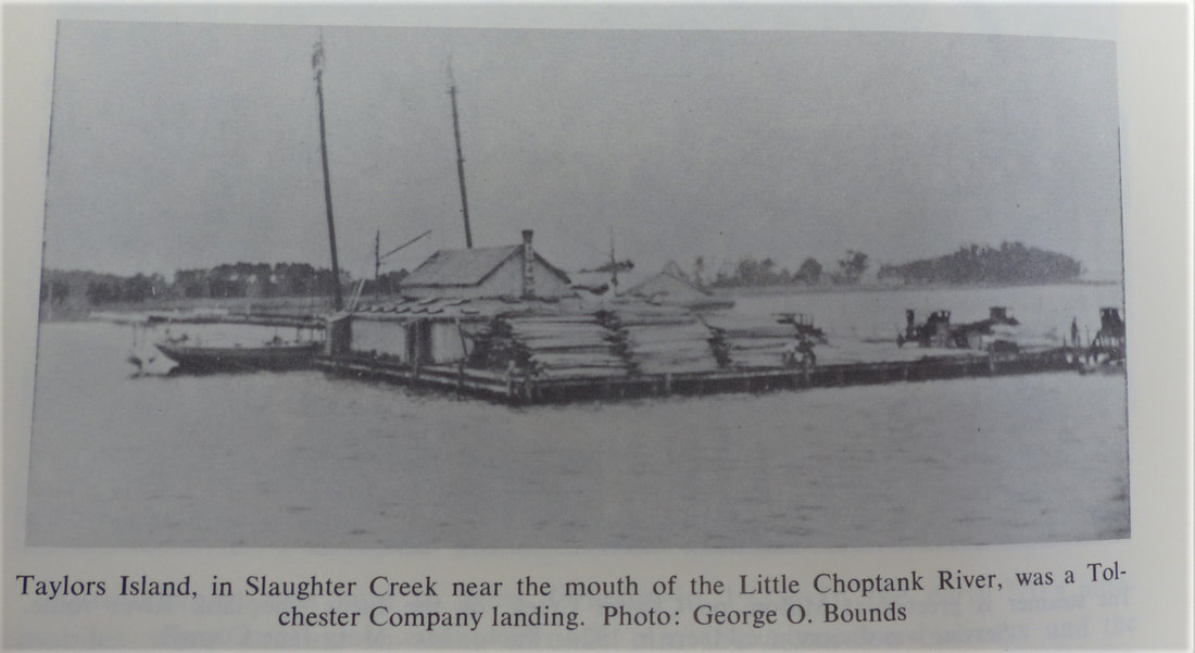
The above photo appears in the book Steamboats Out Of Baltimore by Robert Burgess and H. Graham Wood. The book is available for review in the Maryland Room of the Talbot County Library.
|
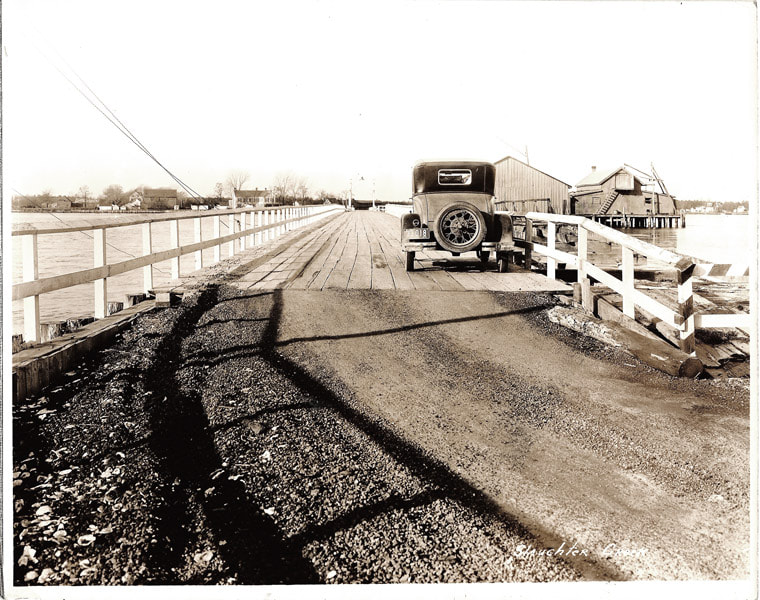
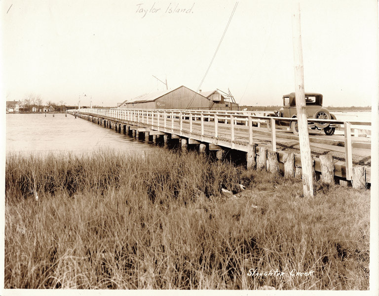
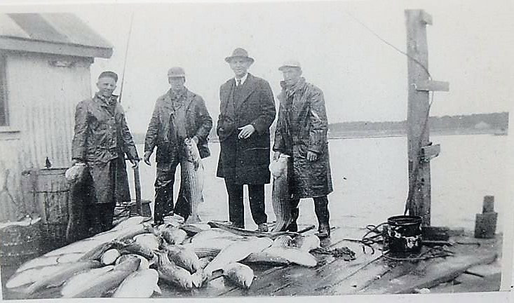
Image of the bridge spanning Slaughter Creek from the 1930s. Mid span is the Harrington seafood receiving and packing facility that operated on the bridge as late as the 1940s.
|
|
Image of the bridge spanning Slaughter Creek from the 1930s. Mid span is the Harrington seafood receiving and packing facility that operated on the bridge as late as the 1940s.
|
|
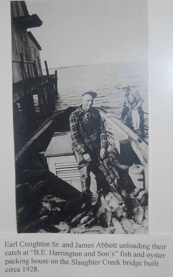
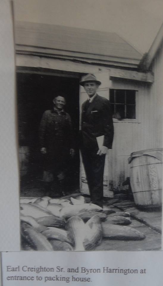
From left: Earl creighton, sr., earl hughes, byron harrington, and james abbott on the packing house attached to the bridge. |
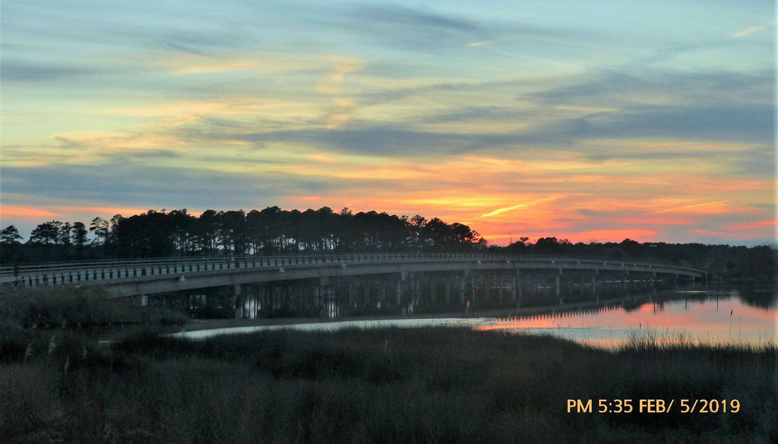
The bridge as it appeared at sunset February 5, 2019.
Survey of Slaughter Creek dated 1880:
General survey or examination of Slaughter Creek Maryland was directed in the River and Harbor Act of 1870. The necessary field work was done by Assistant Johu L Seager and party in October 1879. The map has since been prepared in the office under his supervision. Slaughter Creek is a small branch of the Little Choptank River emptying into the latter on the south side at about 5 miles from its mouth.This stream is in Dorchester County Maryland. Its course and that of its continuation, Little Slaughter, are nearly parallel to the shore of the bay, from which they are separated by Taylor's Island. This is low, like all the country in that section. It is about 5&1/2 miles long and 3&1/2 wide. The island is for a great part under cultivation most of the products being shipped from Ferry Point which is the head of steamboat navigation on the creek. There is a bridge at this point across Slaughter Creek connecting Taylor's Island with the main. The bridge is of wood on piles and is 1,118 feet long. There is a draw in it with a clear width of 26 feet. A steamer makes 3 trips weekly during the spring summer and autumn between Baltimore Slaughter Creek and 4 or 5 landings on the Little Choptank. There is a ship yard just inside the mouth of the creek doing an apparently good business. A 3 masted schooner of about 500 tons was being built there in the summer of 1879. Seven vessels are owned on the creek with an aggregate tonnage of 400. About 50,000 bushels of grain are shipped annually. The settlement at Ferry Point consists of about one dozen families two stores and a post office. Some fruit and ship timber are shipped thence. Besides its mouth into the Little Choptank River, Slaughter Creek is connected with the bay by another opening farther south through what is called Punch's Island Creek. This creek forms the southern limit of Taylor's Island. The survey of Slaughter Creek was confined to the portion between the bridge at Ferry Point and the Little Choptank a distance of about 2&3/4 miles. This section of the creek is almost straight. The following description of it is taken from Mr Seager's notes: Three thousand feet below the bridge the creek is 1,600 feet wide, at 5,000 feet below 900 feet wide, at 8,000 feet below 1,300 feet wide. At the mouth between the points it is 1,500 feet wide.The of et channel at the mouth is 200 feet wide. deepest water in mid channel 10 feet the 8 feet curve extends 1,300 feet inside the mouth and 1,600 feet outside. with a width inside of not less than 150 feet and widening outside to 400 or 500 feet then closing leaving a bar outside with about 33 feet of jo it. Total length of bar from inside 8 feet curve to same outside about eel The 6 feet curve widens out inside the creek to about 400 feet and extends to the bridge narrowing gradually until at the bridge it is only 110 feet wide. There are several bad lumps in this 6 feet channel the water on them ranging from 4 to 5 feet. The shores of the creek are low and flat.The mean range of the tide is about 13 feet. The estimate submitted contemplates dredging a channel 100 feet wide at such points as may be necessary below the bridge to give a depth of 7 feet at mean lowwater. To do so will require the removal of 29,000 cubic yards of material at a cost of $7,250. Very respectfully your obedient servant WM P CRAIGHILL Major of Engineers Brig Gen HG WRIGHT Chief of Engineers USA.
General survey or examination of Slaughter Creek Maryland was directed in the River and Harbor Act of 1870. The necessary field work was done by Assistant Johu L Seager and party in October 1879. The map has since been prepared in the office under his supervision. Slaughter Creek is a small branch of the Little Choptank River emptying into the latter on the south side at about 5 miles from its mouth.This stream is in Dorchester County Maryland. Its course and that of its continuation, Little Slaughter, are nearly parallel to the shore of the bay, from which they are separated by Taylor's Island. This is low, like all the country in that section. It is about 5&1/2 miles long and 3&1/2 wide. The island is for a great part under cultivation most of the products being shipped from Ferry Point which is the head of steamboat navigation on the creek. There is a bridge at this point across Slaughter Creek connecting Taylor's Island with the main. The bridge is of wood on piles and is 1,118 feet long. There is a draw in it with a clear width of 26 feet. A steamer makes 3 trips weekly during the spring summer and autumn between Baltimore Slaughter Creek and 4 or 5 landings on the Little Choptank. There is a ship yard just inside the mouth of the creek doing an apparently good business. A 3 masted schooner of about 500 tons was being built there in the summer of 1879. Seven vessels are owned on the creek with an aggregate tonnage of 400. About 50,000 bushels of grain are shipped annually. The settlement at Ferry Point consists of about one dozen families two stores and a post office. Some fruit and ship timber are shipped thence. Besides its mouth into the Little Choptank River, Slaughter Creek is connected with the bay by another opening farther south through what is called Punch's Island Creek. This creek forms the southern limit of Taylor's Island. The survey of Slaughter Creek was confined to the portion between the bridge at Ferry Point and the Little Choptank a distance of about 2&3/4 miles. This section of the creek is almost straight. The following description of it is taken from Mr Seager's notes: Three thousand feet below the bridge the creek is 1,600 feet wide, at 5,000 feet below 900 feet wide, at 8,000 feet below 1,300 feet wide. At the mouth between the points it is 1,500 feet wide.The of et channel at the mouth is 200 feet wide. deepest water in mid channel 10 feet the 8 feet curve extends 1,300 feet inside the mouth and 1,600 feet outside. with a width inside of not less than 150 feet and widening outside to 400 or 500 feet then closing leaving a bar outside with about 33 feet of jo it. Total length of bar from inside 8 feet curve to same outside about eel The 6 feet curve widens out inside the creek to about 400 feet and extends to the bridge narrowing gradually until at the bridge it is only 110 feet wide. There are several bad lumps in this 6 feet channel the water on them ranging from 4 to 5 feet. The shores of the creek are low and flat.The mean range of the tide is about 13 feet. The estimate submitted contemplates dredging a channel 100 feet wide at such points as may be necessary below the bridge to give a depth of 7 feet at mean lowwater. To do so will require the removal of 29,000 cubic yards of material at a cost of $7,250. Very respectfully your obedient servant WM P CRAIGHILL Major of Engineers Brig Gen HG WRIGHT Chief of Engineers USA.
The above image is a photograph of a page from Dorchester County Fact Book by Calvin Mowbray (1981). This book is available for review in the Maryland Room of the Talbot County Library.
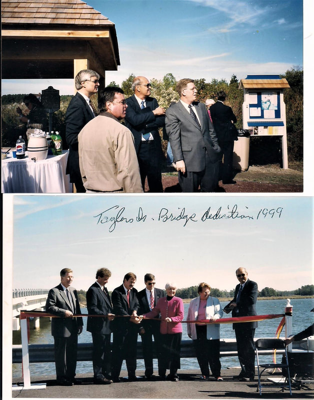
The below photos were taken at the bridge dedication in 1999.
The below photos were taken at the bridge dedication in 1999.
|

|
Below are two photos of the wooden bridge in as it appeared in 1997