As Taylors Island and James Island were once connected so they remain intertwined in spirit despite the sad fact that James Island is quickly disappearing. James Island is just north of Taylors Island at the intersect of Chesapeake Bay and the Little Choptank River. It was once connected to Taylors Island and the approach over land was via Taylors Island. Now there is at least half a mile of open water between the islands. If you look at a recent photo of James Island it may be hard to picture a vibrant community existing there. When it was settled in the 1660s it was called St. James Island and totaled 1,350 acres.
By 1877 James Island had split into two land masses with a total acreage of 1,134. It then had about a dozen homes, a school and a store. Captain James T. Leonard was the storekeeper. A Methodist church was built there in 1881 and in 1892 twenty families lived there. The church burned about 1905 and by 1910 all but seven residents moved to the mainland.
Sika Deer, which are actually tiny elk native to Asia, were imported to the island in 1916 by Cambridge, Maryland resident Clement Henry. Of course, they eventually migrated to the mainland and today there is a huge population of Sikas on the Eastern Shore of Maryland. Sika deer hunting is immensely popular and brings many hunters to the Eastern Shore for the specific purpose of bagging one. No deer remain on the island now-a-days.
The U.S. Army Corps of Engineers issued a Fact Sheet update as of March 1, 2018 indicating that there has been an Island Ecosystem Restoration Feasibility Study. The study focused on restoring/expanding island habitat to provide hundreds of acres of wetland and terrestrial habitat for fish, shellfish, reptiles, amphibians, birds, and mammals through the beneficial use of dredged material. Restoration will provide indirect benefits of navigational safety, education, and passive recreation and perhaps, increased tourism. The conceptual plan for the feasibility study proposes 55 percent wetland and 45 percent upland habitats. Habitat may include submerged aquatic habitat, mudflat, low marsh, high marsh, islands, ponds, channels and upland areas. Commencement of restoration is dependent upon budgeting issues.
Update on James Island Restoration 8/23/2019:
https://www.dvidshub.net/news/337031/army-corps-maryland-port-administration-sign-agreement-moving-chesapeake-island-restoration-forward
DORCHESTER COUNTY, MD, UNITED STATES
BALTIMORE – The U.S. Army Corps of Engineers, Baltimore District, and the Maryland Port Administration have signed a Design Agreement that allows for the next steps in restoring two severely degraded islands in the Chesapeake Bay.
The Mid-Chesapeake Bay Island Ecosystem Restoration Project is a partnership between the Corps of Engineers and the MPA that focuses on restoring and expanding island habitat at James and Barren islands to provide thousands of acres of wetland and terrestrial habitat for fish, shellfish, reptiles, amphibians, birds, and mammals through the beneficial use of material dredged from Baltimore Harbor approach channels.
“The Corps of Engineers executes many missions and projects that benefit the Nation, including maintaining federal navigation channels and large-scale ecosystem restoration projects,” said Baltimore District Commander Col. John Litz. “We’re proud to partner with the Maryland Port Administration on this large-scale ecosystem restoration project that will have a significant beneficial impact on the Port of Baltimore and the economy.”
“This agreement between Maryland and the Corps of Engineers benefits our economy and our most important natural asset, the Chesapeake Bay,” said Maryland Governor Larry Hogan. “The Port of Baltimore is an important economic giant in Maryland and throughout the East Coast. I’m pleased that through this critical dredging project we can assist the Port’s growth while also stemming the tide of erosion at James and Barren islands.”
The recently signed Design Agreement formally allows for the team to begin the complex pre-construction engineering and design phase (PED) of this project, generally referred to as the Mid-Bay Island Project. The PED phase is the last major step before construction.
Over the past several decades, James and Barren islands in western Dorchester County have experienced significant erosion. The Mid-Bay Island Project will involve the restoration of these islands, while designing them to be able to accept clean material dredged from navigation channels. James Island will accept material from channels in the Maryland waters of the Chesapeake Bay used by ships going to and from the Port of Baltimore and Barren Island will accept material from nearby shallow-draft channels.
At the larger James Island, the island’s boundaries will be reinforced to prevent erosion, and cells will be delineated within the island where dredged material will be placed over the years to rebuild the island. The process will be very similar to the successful Paul S. Sarbanes Ecosystem Restoration Project at Poplar Island to the north in the Chesapeake Bay. Poplar Island began construction in 1998 and currently accepts dredged material. To date Poplar Island has accepted roughly 34 million cubic yards of material. An expansion of Poplar Island is nearly complete, and will increase its capacity until the Mid-Bay Island Project can accept dredged material.
The recommended Mid-Bay plan consists of constructing environmental restoration projects to restore 2,144 acres of remote island habitat (2,072 acres at James Island and 72 acres at Barren Island). The James Island restoration includes a habitat distribution of 45 percent upland and 55 percent wetland. Barren Island will be restored to 100 percent wetland habitat.
James Island will be able to accept an estimated 90 to 95 million cubic yards of dredged material, which should provide at least 30 years of dredged material placement capacity for maintenance dredging associated with the Port of Baltimore.
The pre-construction engineering and design phase will begin right away, and the first of many construction projects will restore Barren Island and protect it from future erosion. That work is scheduled to begin in 2022 pending the availability of funds, and would be followed two years later by construction of James Island.
For more information about the Mid-Bay Island Project, please visit our web site at: http://www.nab.usace.army.mil/Mid-Bay
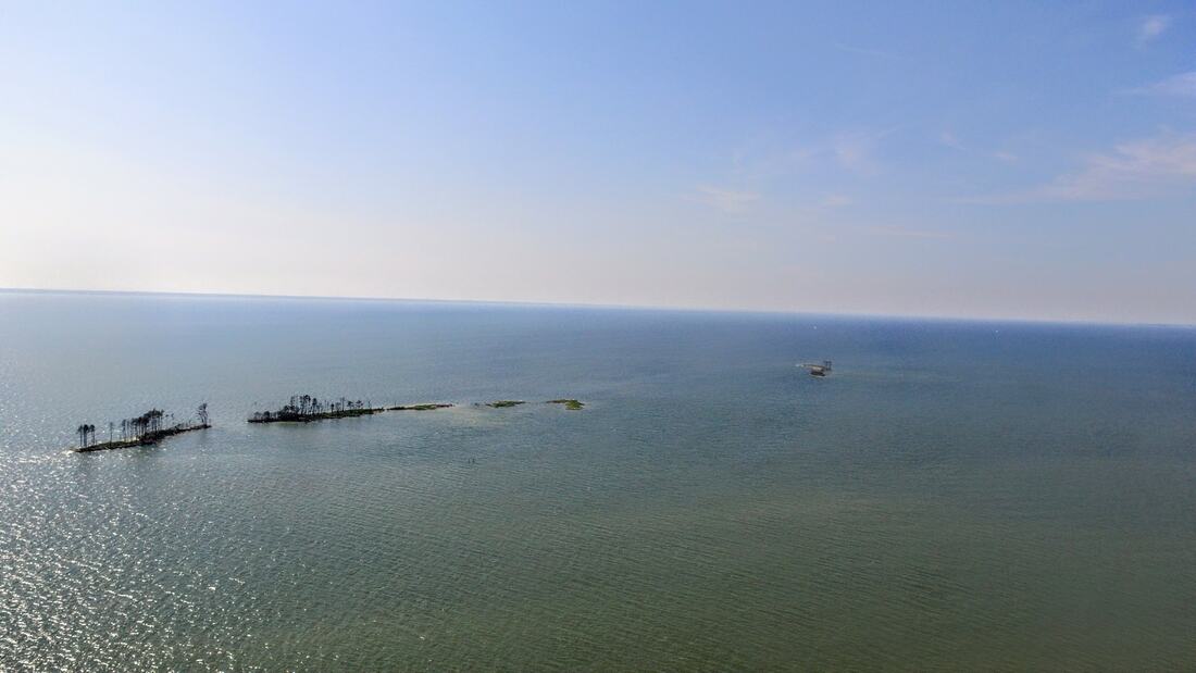
Above photo is James Island taken in July 2018 (From the Maryland Frontier Facebook Page)
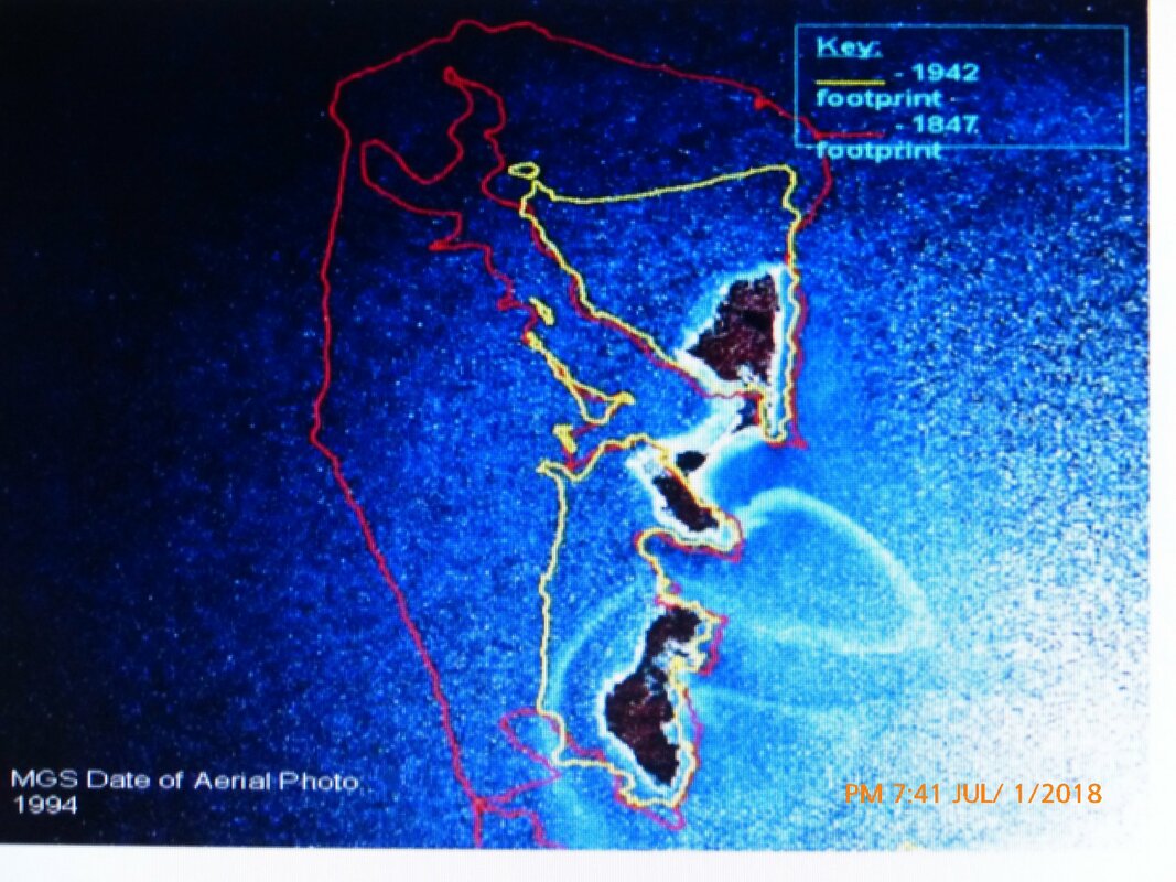
Above image James Island aerial photo from 1994 with superimposed island footprints from approx 150 years prior and 50 years prior.
Red = 1847
Yellow = 1942
Red = 1847
Yellow = 1942
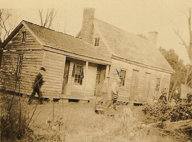
Above image - Capt. J. Everett Dean at his home on James Island, Md, 1928 (photo courtesy of family photo collection of Stephanie Coleman Elliott).
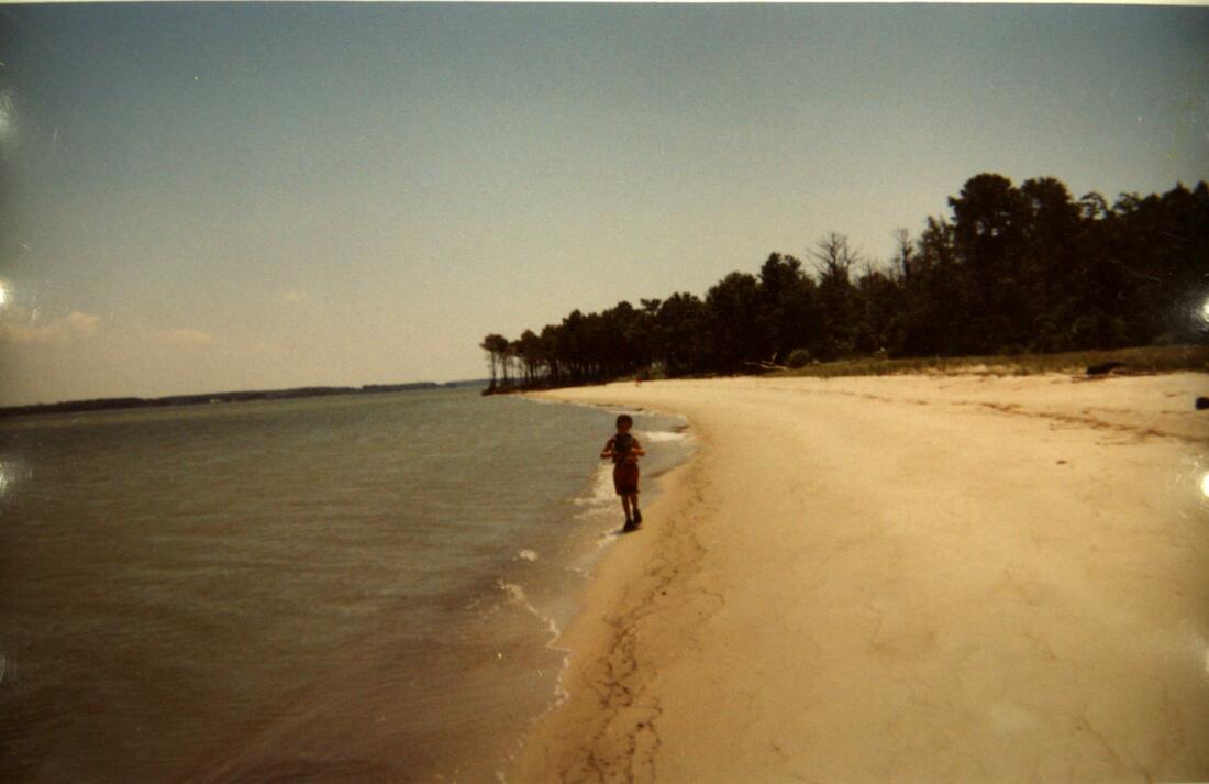
Above image - Michael T. Geleta in a photo taken on east side of James Island in approximately the year 2000.
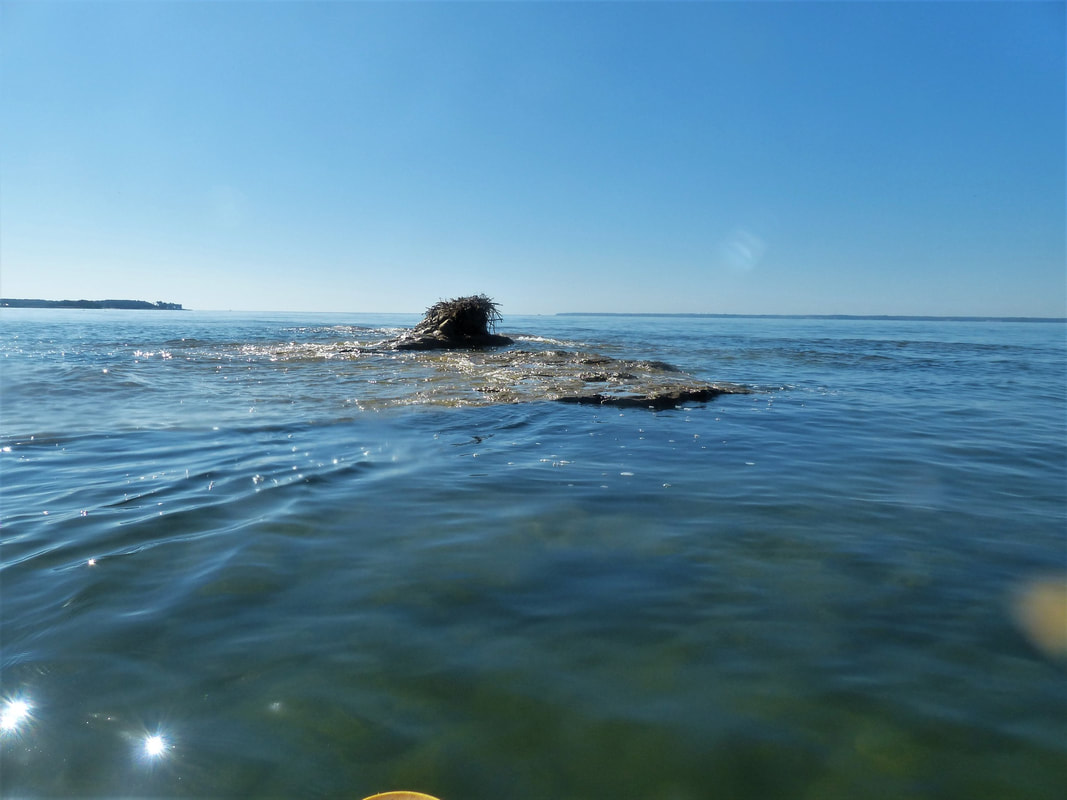
Below image taken in October 2022 and shows the same spot and camera angle as the above photo (both phots taken by Michael's father). As you can see the island has almost entirely eroded
Below image taken in October 2022 and shows the same spot and camera angle as the above photo (both phots taken by Michael's father). As you can see the island has almost entirely eroded
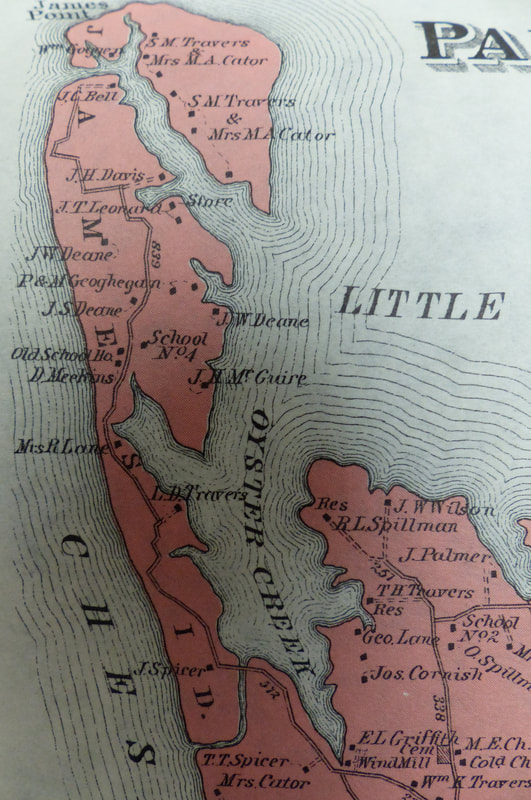
Above image - late 19th century map showing James Island with its minimal separation from Taylors Island.
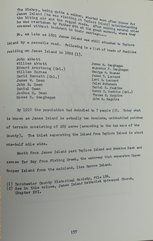
The above image is a photograph of a page from Dorchester County Fact Book by Calvin Mowbray (1981). This book is available for review in the Maryland Room of the Talbot County Library,
